Bokonbayevo (Bokombayevskoye)
Bökönbaev (Бөкөнбаев, Боконбаево) is a village in the Issyk-Kul Region of Kyrgyzstan. It is the seat of the Tong District and of the Kün-Chygysh village community. It was established as Kol'tsovka village in 1912. With a population of 14,267 (2021), it is the largest village on the south shore of lake Issyk Kul. Its industry has decayed since Soviet times. It is now a base for tourism into the mountains to the south. There are demonstrations of falconry with eagles. The road to the west to Balykchy goes through dry and less-attractive country.
Map - Bokonbayevo (Bokombayevskoye)
Map
Country - Kyrgyzstan
 |
 |
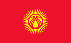
| Flag of Kyrgyzstan | |
Ethnic Kyrgyz make up the majority of the country's 6.6 million people, followed by significant minorities of Uzbeks and Russians. The Kyrgyz language is closely related to other Turkic languages.
Currency / Language
| ISO | Currency | Symbol | Significant figures |
|---|---|---|---|
| KGS | Kyrgyzstani som | Ñ | 2 |
| ISO | Language |
|---|---|
| KY | Kirghiz language |
| RU | Russian language |
| UZ | Uzbek language |


